Destination Run: Wildwood Canyon Trail, L.A.
Jun 16, 2025
 1
1
 Destination Run: Wildwood Canyon Trail, L.A. www.runnerclick.com
 Los Angeles: The city of big dreams, crowded highways, and the glittery celebrity of Hollywood. Lovely nature trails and breathtaking lookout points are probably the last things that come to mind when thinking of LA, but they do exist. They are the hidden gems of this bustling city and an important part of the local running community. One of the favorites around here is the Wildwood Canyon Trail in the Verdugo Mountains, near the suburb of Burbank.
The 2.3 miles long Wildwood Canyon Trail, also known as “The Burbank Butt Burner”, provides a nearly 1,000ft elevation gain and beautiful views overlooking Los Angeles. This well-maintained trail run is the perfect midweek indulgence or highlight of an L.A. business trip. Although it’s not a long trail per se, don’t be fooled – the dirt path is steep in many sections and makes for an excellent cardio workout. In spring, the trail is lined with pretty wildflowers. And in sunny California, almost every season is perfect for running.
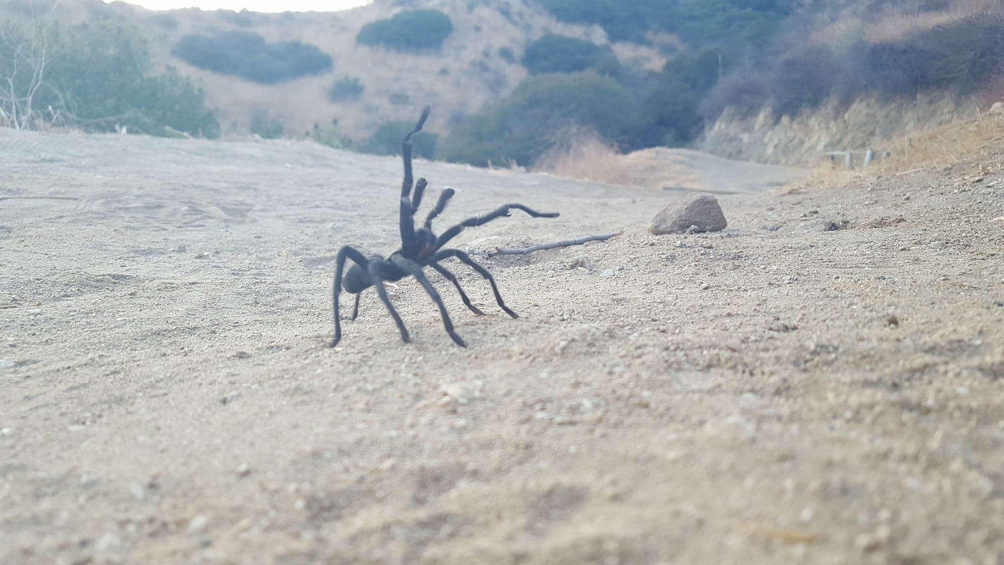
The trail is in Wildwood Canyon Park in Burbank (not to be confused with Wildwood Regional Park in Thousand Oaks, about an hour north). The park is covered in a fragrant desert shrub named chaparral and a network of nature trails. Set in the Verdugo mountain range just above Los Angeles, there are many trail options for walking, running, and hiking. The trails are well-loved by local runners because they’re conveniently close to the city and offer solid cardio in a gorgeous setting. You might even see some wildlife, which is a treat so close to L.A. Keep your eyes peeled for mule deer, coyotes, tarantulas, gray foxes and much more.
Getting There
Wildwood Canyon Park, 1701 Wildwood Canyon Drive, Burbank, CA
From Interstate 5 take the Burbank Boulevard exit and make your first right onto N. 3rd Street, then make the first left onto E. Harvard Road. When you reach Wildwood Canyon Road, turn right and continue for a short distance until you see the sign for Wildwood Canyon Park. The park entrance will be on your left, as will the parking lot. Parking is free and plentiful, but make sure you only park on the paved area. As an alternative, you can drive up into the park to shorten your run or to start at a higher elevation (just be warned, they close the gates at dusk).
The trailhead is about 50 feet after the park entrance, on the left (same side as the parking lot). There’s a drinking fountain and a public restroom just before the trailhead.
The Route
This lightly trafficked canyon and ridge trail are classed as moderate, providing great cardio because of a few reasonably steep sections. Although the trail is well-maintained, it branches off in a few areas, so it’s helpful to know your route before you go.
- The trail will rise steeply out of the canyon. You’ll run through a series of switchbacks, and over several old railroad tracks.
- Stay to your left at the first V intersection. Stay right at the second V intersection. Stay left at the third V intersection, staying on the broad ridge trail the whole time.
- At the fourth V intersection, stay left to stay on the ridge trail. Turning right would lead you back down into the canyon, and to a cleared area with a picnic table and a pretty vista. It gets even steeper now, keep climbing! This is where the real cardio begins, and the views behind you will be lovely.
- At the fifth intersection, you can go right or left – they both come back to join the same trail again. Going to the right is a little bit of a longer trail.
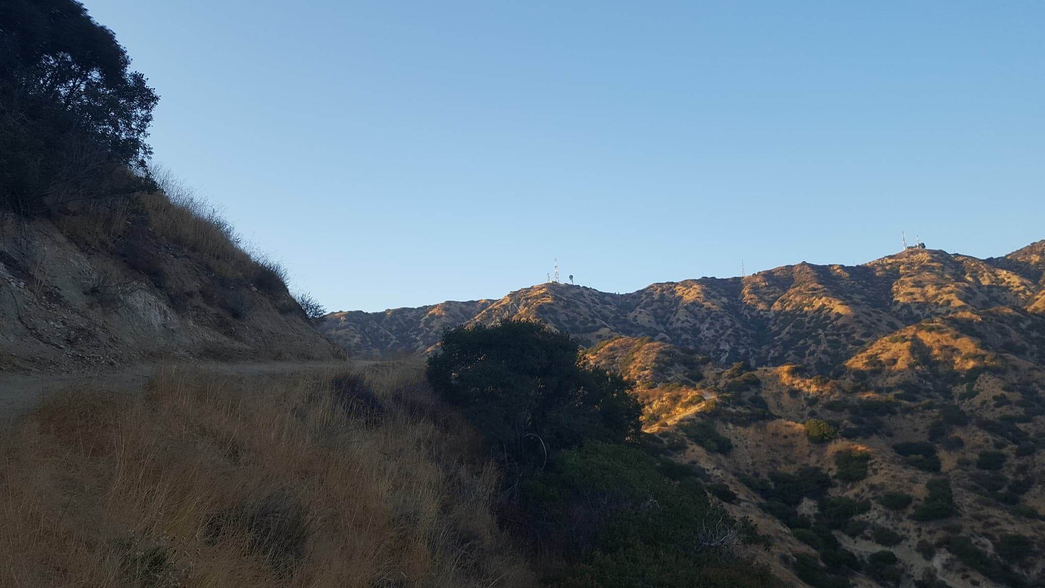
- Follow the ridge up to the communications structures which you will see in the distance. Here you will find a posted sign with a map of the Vital Link trail, and the Willie Mann Memorial Chair – a donated bench where you can sit and enjoy the stunning vista.
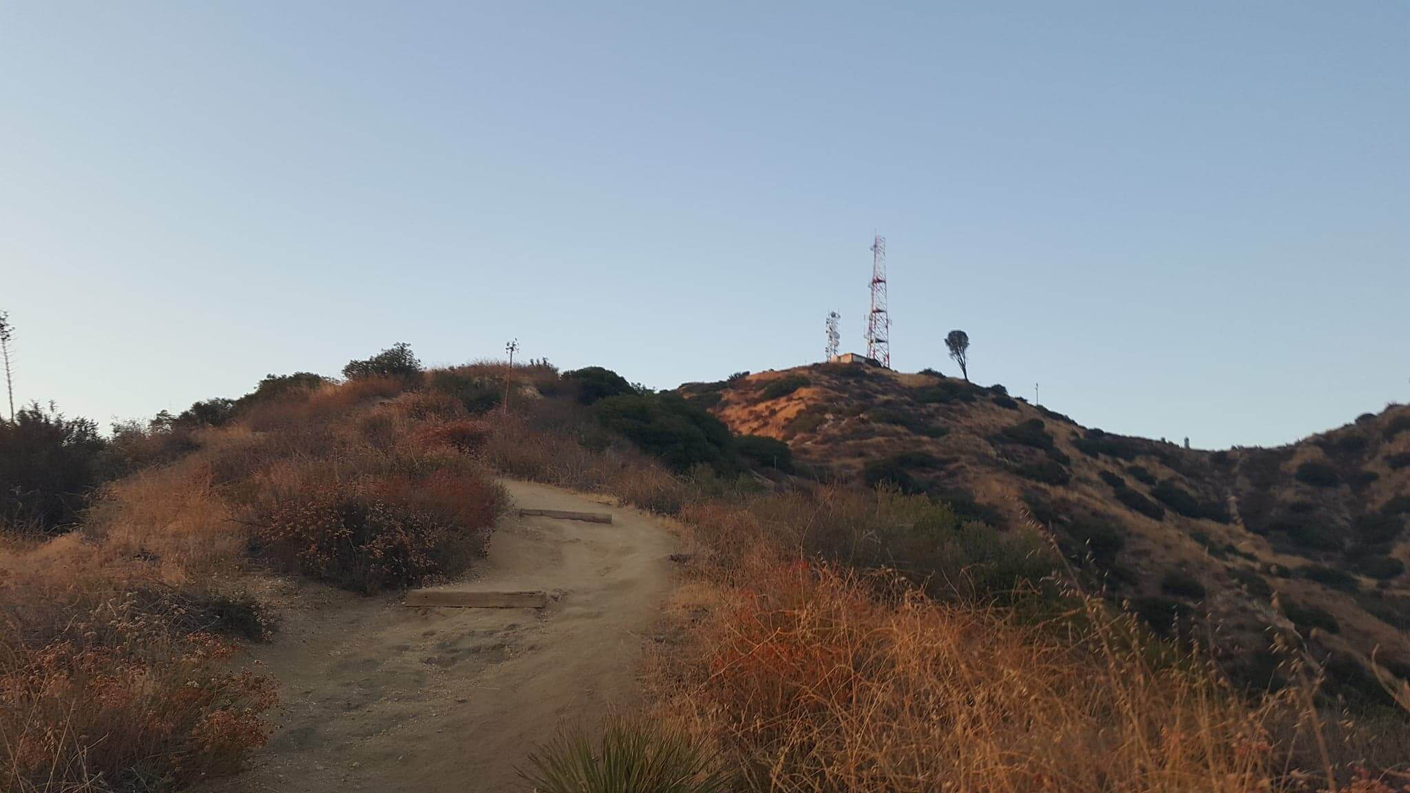
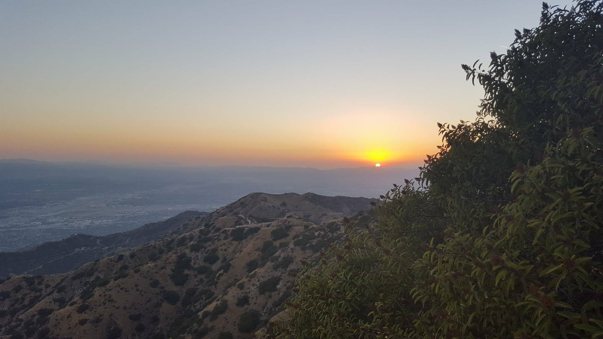
Optional: If you want to continue ascending to the summit proper, there’s a dirt fire road named the Verdugo Motorway that will take you all the way to Verdugo Peak. Follow the Vital Link trail map to reach the top. From here, the trail evens out and turns into more of an ambling nature walk. This optional side trip to the summit will offer breathtaking views of the Crescenta and San Fernando Valleys, with the San Gabriel Mountains in the background.
Trail Tips
- Bring a snack to munch on while taking a quick break and enjoying the incredible views from the bench at the top.
- Definitely bring your camera or phone, the sweeping vistas are worth taking a photo.
- Bring lots of water and sun protection. It can get hot and sweaty, especially in summer (and it’s almost always summer in California).
- Bring poles for the ridge sections if you are hiking and accustomed to using poles.
- Dogs on a leash are ok, but no bicycles on the trail are allowed.
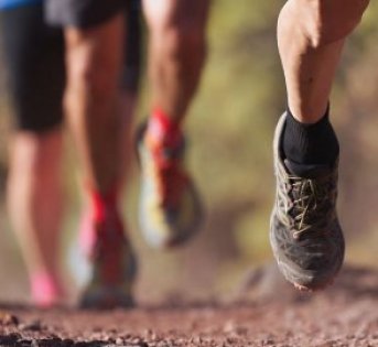
- Wear sturdy or trail running shoes.
Latest Articles
 Is Running on a Treadmill Easier Than Running Outside?Runners have their own preferences, whether it is treadmill running, running outside on the road, or exploring trails. So...
 Is It OK to Use Trail Running Shoes on the Road?While trail running shoes can be used on roads, especially in situations where a runner encounters mixed terrains or pref...
 How to Fix Sore Quads After Running?Rest, ice, gentle stretching, and over-the-counter pain relievers can help soothe sore quads after running. Also, ensure ...
 10 Fruits With The Most Electrolytes to Replace Sports DrinksThese fruits are high in electrolytes such as potassium, magnesium, and calcium, essential for hydration, muscle function...